Atms
Submitted by: Submitted by bigheadcat
Views: 711
Words: 678
Pages: 3
Category: Science and Technology
Date Submitted: 06/24/2012 12:19 PM
Challenge Problem: Satellites and Radar
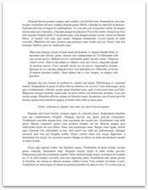
1. Examine the satellite image below and answer the questions that follow.
[pic]
a. What satellite channel was used to make this image?
Visible, Infrared or Water Vapor (circle one)
b. What type of orbit was this satellite in that took this image?
Geostationary Orbit
c. Why is the eastern most edge of this image dark?
Because visible channels measure reflected visible sunlight. Without sunlight (during night-time), we cannot use this channel to observe the weather. It’s dark.
d. This image was made at 0300 UTC February 9, 2011, what time is that locally?
9pm CST February 8, 2011.
2. Match the correct satellite channel to the descriptions given below.
a. Visible
b. Infrared
c. Water Vapor
( This satellite channel is ideal for measuring the cloud top temperature of a thunderstorm _b_
( An object with a low albedo will appear dark on this type of satellite image __a_
(This satellite channel works really well during the day, but not so well at night __a__
( This satellite channel would be the best to use if I wanted to compare the dryness of the air over the Sahara Desert to the very humid air over the tropical rainforest in central Africa. _c__
( Snow cover would appear bright on this satellite image __a_ and dark on this image __b__
(This satellite channel works best at 3AM (local time) to view clouds __a__
To answer the series of questions given below, you will need to open the following file.
http://www.atmos.illinois.edu/~snodgrss/WCP-3.pdf
Questions on Slide #1
1. Focus on the radar sites that are highlighted by the three white arrows.
a. What “mode” of operation were these radars operating in when this national radar image was made?
Clear Air Mode.
b. What do meteorologists call the radar echoes that surround the radar but are not from...